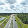
We provide innovative engineering solutions to real-world challenges by combining bleeding edge technologies with a forward thinking team of engineers and industry experts. Let us capture and preserve each stage of the construction process using our aerial technologies and high resolution cameras. Aerial technologies will transform your surveying and mapping projects.
We provide near real-time aerials, 3D models, and highly accurate point clouds and contours for 10 to 10,000 acre sites. We are a leader in comprehensive environmental assessments and gathering data for projects ranging from landfills to wetlands identification and preservation. We provide custom, client-centered, solutions for a wide array of projects aimed at solving real problems with your business.
We provide near real-time aerials, 3D models, and highly accurate point clouds and contours for 10 to 10,000 acre sites. We are a leader in comprehensive environmental assessments and gathering data for projects ranging from landfills to wetlands identification and preservation. We provide custom, client-centered, solutions for a wide array of projects aimed at solving real problems with your business.
Services
Dragonfly AeroSolutions will provide the highest level of professional aerial services to our clients, by leveraging over 80+ years of technical knowledge and infield experiences coupled with 13+ years and over 10,000 flight hours of unmanned aerial vehicle (UAV) expertise. We will partner with our clients to develop new and innovate ways to meet the challenges of tomorrow, while also helping them take their existing programs to the next level.
Through the combination of our industry leading technology and professional staff, we are able to provide a new level of data and information to your engineering team. A combination of near real-time aerial photos, site videos and data sets bring your project to your fingertips. We deliver more information in less time at lower cost using our aerial technologies and sensors for value engineering services.
We quickly gather data in the field using industry leading drone and sensor technology to help ensure on-time project completion. Know where you are during construction by documenting the project using our aerial solutions. Pictures, videos, 3D models and CAD based data are great ways to document milestones in your projects.
Our drone and sensor technologies coupled with our in-house professional engineering team are capable of surveying and mapping thousands of acres a day. Accurate point clouds, contours, orthomosaic aerials and more are delivered within days of field work. No longer is your data tied to a 100' x 100' or 50' x 50' grid.
Time matters when dealing with environmentally sensitive projects. Our state-of-the-art aerial fleet and technologies allow us to provide near real-time information from remote locations on projects of all sizes. Drones enable us to record data in more places faster than ever before. Our clients leverage our years of expertise doing drone data collection and processing to expedite their research and analysis.
Reviews

Be the first to review Dragonfly AeroSolutions.
Write a Review
